Cycling Routes of Garda Trentino
From Arco to Riva del Garda up to the trails of Ledro Valley, a practical guide for every kind of cyclist.

If you’re planning to explore the Trentino side of Lake Garda by bike, I can help you choose the cycle route that best suits your preferences with some useful information on the various routes. In this part of the lake, the landscape changes rapidly: there are scenic routes perfect for a leisurely ride, road routes if you’re looking for longer rides, as well as various technical trails through the woods if you enjoy mountain biking. In this article, I’ve compiled and selected a few cycling routes in Garda Trentino that suit your fitness level, the time you want to spend on your ride and the type of bike you own.
Tourist Routes
If your aim is to explore Garda Trentino at a leisurely pace, the tourist routes are the obvious choice for cyclists who enjoy pedalling while admiring the scenery. The routes often follow cycle paths that run through long, flat stretches. With the lakeshore on one side and countryside dotted with vineyards and small villages to pass through on the other, they create the perfect natural setting for a leisurely ride.
These routes are also suitable if you’re not particularly fit, are travelling with your family or simply want to get some exercise in the open air. The climbs are gentle, the surfaces even and there are plenty of scenic spots, so you can enjoy the beauty of the area safely and without any technical difficulties.

Monte Brione Loop Route
The Monte Brione loop route is a simple, completely flat itinerary, ideal for a sightseeing tour around one of the most recognisable mountain silhouettes in the upper Lake Garda area. Located on this mountain there are some military structures dating from the Austro-Hungarian era, which I discussed in detail in my article titled The Mount Brione Forts in Garda Trentino. This route alternates between cycle paths and minor roads, passing through the surrounding countryside and a few villages. The lakeside stretch between Torbole and Riva del Garda is much loved for its views of the lake, but in summer it is particularly busy, so care should be taken at pedestrian crossings where people are heading towards the beach.

- 1 Riva del Garda Start
- 2 Porto San Nicolò
- 3 Sant'Alessandro
- 4 Lido di Arco
- 5 Riva del Garda Finish
- MAP
Adige – Lake Garda Cycle Route
The Adige – Lake Garda cycle route links the town of Mori with the town of Torbole sul Garda and is one of the most popular sections of the cycle route that runs from the Brenner border southwards to the city of Verona. The route passes through the green vineyards of the Val d’Adige, runs alongside Lake Loppio until it reaches Passo San Giovanni (287 m) and finally descends towards the northern shore of Lake Garda near Torbole. The route is almost entirely flat, presents no particular technical difficulties and is suitable for cyclists of all abilities.

- 1 Mori Start
- 2 Loppio
- 3 Nago
- 4 Torbole sul Garda
- 5 Lido di Arco
- 6 Riva del Garda Finish
- MAP
Garda Trentino Loop Route
The Garda Trentino loop is quite a long route, but it’s ideal if you want to explore a large part of this area by bike. The route starts from Riva del Garda, passing through the olive groves that characterise the landscape as far as Arco, before following the course of the River Sarca towards the Marocche, one of the most distinctive and well-known natural areas in Garda Trentino. From here, the route continues to Lake Cavedine and climbs up to Sarche, before turning back and descending once more towards Lake Garda.

- 1 Riva del Garda Start
- 2 Varone
- 3 Ceole
- 4 Vigne
- 5 Arco
- 6 Dro
- 7 Marocche
- 8 Lago di Cavedine
- 9 Pergolese
- 10 Sarche
- 11 Pietramurata
- 12 Ceniga
- 13 Massone
- 14 Lido di Arco
- 15 Riva del Garda Finish
- MAP
Torbole sul Garda – Sarche Cycle Route
The Torbole sul Garda – Sarche cycle route is one of the most popular with cycle tourism enthusiasts, thanks to the variety of landscapes it passes through and its accessibility, which also makes it perfect for those travelling with children. It starts from the lakeside and follows the Sarca Valley along a smooth route that passes through the countryside and a number of small villages. The ride is consistently pleasant, with even surfaces and numerous scenic viewpoints. Along the way, there are many farms where you can stop for a tasting of local food and wine specialities.

- 1 Torbole sul Garda Start
- 2 Pratosaiano
- 3 Arco
- 4 Dro
- 5 Pietramurata
- 6 Sarche Finish
- MAP
The Busa Tour
The Busa tour is an easy circular route that roughly follows the perimeter of a vast flat area situated between the towns of Arco, Riva del Garda and Torbole, known as the "Busa" – meaning “hollow” in Italian – due to its shape, which resembles a basin surrounded by high mountains. The route runs along cycle paths and secondary roads, with smooth stretches connecting the main towns of this area to the countryside.

- 1 Riva del Garda Start
- 2 Varone
- 3 Vigne
- 4 Arco
- 5 Lido di Arco
- 6 Riva del Garda Finish
- MAP
Riva del Garda - Busatte
The Riva del Garda – Busatte cycle route presents no technical difficulties and is the ideal choice if you fancy a short bike ride to enjoy the views. The cycle path runs along the lakeside to the historic centre of Torbole; from there, the road climbs gently until it reaches the Busatte area, the starting point for a pleasant Excursion on the Busatte Tempesta trail.

- 1 Riva del Garda Start
- 2 Lido di Arco
- 3 Torbole sul Garda
- 4 Busatte Finish
- MAP
Road Routes
The Garda Trentino offers a number of road routes that are perfectly suited to a day of competitive cycling. In this section, I have put together a selection of tarmac routes that alternate between fast sections and steady climbs, ideal both for training and for enjoying the views of the surrounding countryside.
From the roads climbing up towards Lake Tenno to the slopes leading to the most picturesque viewpoints, each route has its own distinct character that is well worth discovering. These routes are ideal for cyclists looking for a more dynamic ride, whilst still keeping it enjoyable and within the limits of a standard level of training.
Riva del Garda - Lago di Tenno
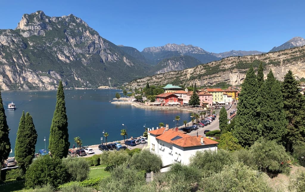
The Riva del Garda – Lake Tenno circular route starts from the well-known town on Lake Garda and climbs gradually along a road open to traffic towards the villages of Deva and Pranzo. The climb leads close to Lake Tenno and the medieval village of Canale, one of the most picturesque spots in Garda Trentino and an ideal place for a short stop. The road then begins to descend towards the villages of Ville del Monte and Tenno, passing very close to the medieval castle. The route is not particularly difficult, but the climb in the first part of the circuit is long and requires a reasonable level of fitness.

- 1 Riva del Garda Start
- 2 Foci
- 3 Deva
- 4 Pranzo
- 5 Lago di Tenno
- 6 Ville del Monte
- 7 Tenno
- 8 Fontanelle
- 9 Varone
- 10 Riva del Garda Finish
- MAP
Torbole sul Garda - Malcesine
The Torbole sul Garda – Malcesine cycle route runs for the most part along the Gardesana, a very dangerous road for cyclists that runs just a few metres from the lake. The route heads south, passing through the villages of Tempesta and Navene, with a steady and consistently straight course. Once you reach the town of Malcesine, the road climbs up to Passo Campiano (375 m) before descending again towards the Gardesana and returning to the starting point. It is a good idea to plan to set off in the morning to have the Pelèr in your favour – the local wind that blows from the north – whilst returning in the afternoon allows you to have the Ora in your favour, the local wind that blows from the south. During the summer, road traffic on the Gardesana road is very heavy and requires the utmost caution throughout the entire journey.

- 1 Torbole sul Garda Start
- 2 Tempesta
- 3 Navene
- 4 Malcesine
- 5 Navene
- 6 Tempesta
- 6 Torbole sul Garda Finish
- MAP
Lago di Ledro - Pregasina
The Lake Ledro – Pregasina cycle route starts in the village of Molina di Ledro and heads down towards Lake Garda, passing through a few small villages, until it joins the Ponale trail. After a few hairpin bends on the descent, the road begins to climb towards the village of Pregasina, offering numerous panoramic views of the surrounding landscape. From Pregasina, if you have time, you can also enjoy a pleasant Excursion to the Punta Larici trail, a short walking route through the woods leading to one of the most spectacular natural viewpoints in the Garda Trentino area.
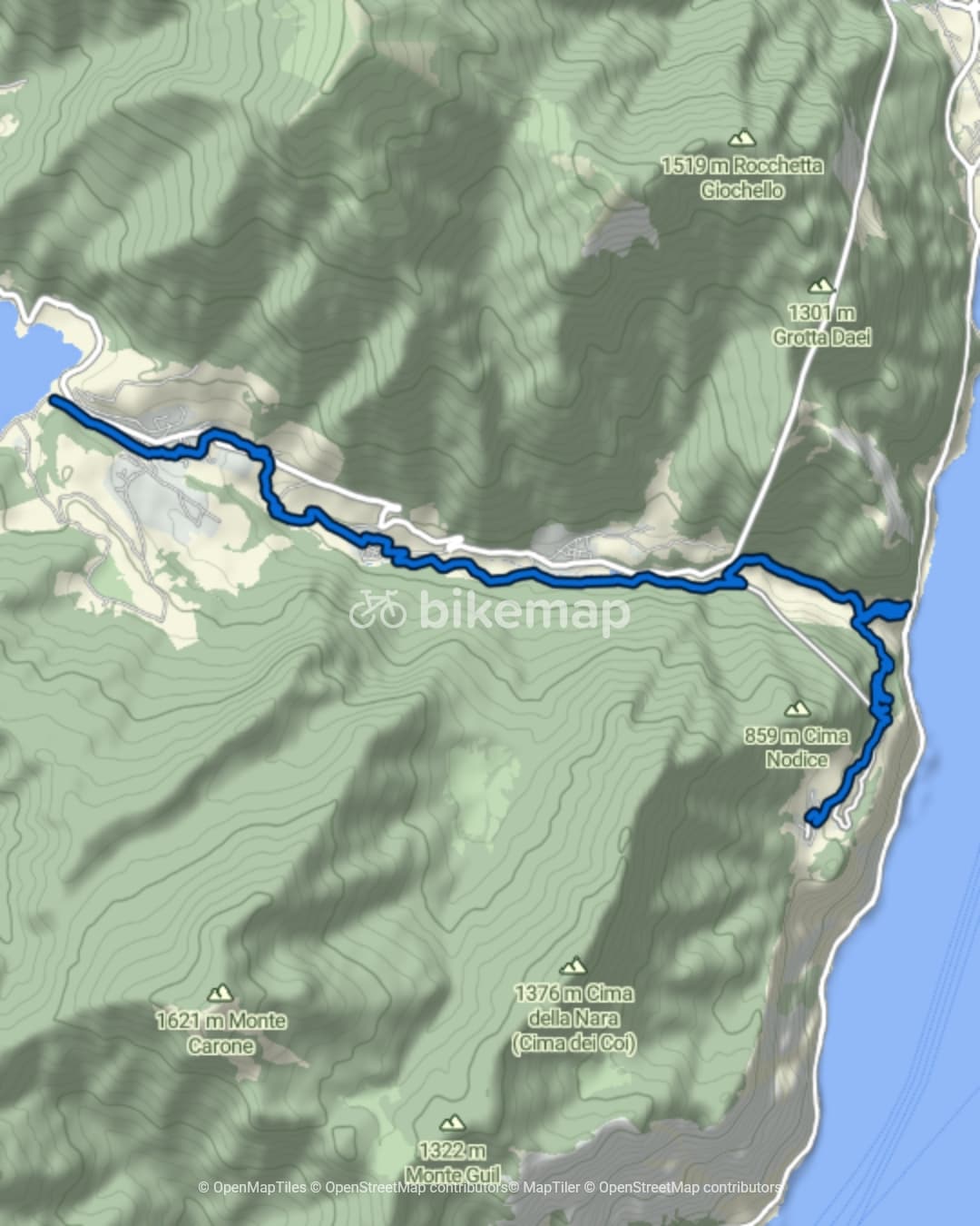
- 1 Molina di Ledro Start
- 2 Barcesino
- 3 Prè di Ledro
- 4 Biacesa di Ledro
- 5 Sentiero del Ponale
- 6 Pregasina Finish
- MAP
MTB & Gravel Routes
In this section, I have put together a selection of cycling routes that are very different from one another, but which are a must for any cycle tourist visiting the Lake Garda area. You can choose to cycle towards the Ledro Valley with its smooth dirt tracks, or tackle one of the most technical routes in Garda Trentino, which climbs up to Monte Altissimo di Nago. Depending on your fitness level and the time you wish to devote to your ride, you can choose to head for the forest tracks of Concei Valley, the peaceful Lake Ampola, or enjoy the views from the Ponale trail.
Some routes are easy and suitable for those who simply want to explore the area on even terrain without too much effort, whilst others require greater technical skill and fitness, particularly when tackling old mule tracks or very steep descents on uneven ground. Whatever you choose, enjoyment will be the common thread running through every ride.

Arco - Centrale di Fies
The Arco – Centrale di Fies cycle route is fairly easy, with an almost entirely flat surface, making it ideal if you want to cycle away from traffic. The route takes you along some cycle paths and secondary roads through a rural area dotted with vineyards and cultivated fields. Along the way, there are some small villages where you can stop for a short break before continuing on to the Centrale di Fies and then heading back.

- 1 Arco Start
- 2 Ceniga
- 3 Dro
- 4 Fies
- 5 Dro
- 6 Ceniga
- 7 Arco Finish
- MAP
Pratosaiano Loop Route
The Pratosaiano loop route starts and finishes in the town of Arco and follows a number of quiet secondary roads, making it ideal for a peaceful cycle ride. The route is almost entirely flat and passes through a rural area where vineyards and apple orchards alternate with small hamlets. The short distance and even terrain make it a route suitable for everyone, with a slow and steady pace that allows you to enjoy the rural landscape of Garda Trentino without rushing.

- 1 Arco Start
- 2 Pratosaiano
- 3 Bolognano
- 4 Massone
- 5 Arco Finish
- MAP
Riva del Garda - Molina di Ledro
The Riva del Garda – Molina di Ledro cycle route is one of the most popular itineraries for tourists on holiday in the upper Lake Garda area. The route starts in Riva del Garda and immediately takes the Ponale trail, the old road that once linked Lake Garda to the Ledro Valley, which is now closed to traffic and reserved for cyclists and pedestrians. The first section of the climb, on a dirt track, is gentle and offers stunning views, carved entirely out of the rock overlooking the lake. Once past this historic stretch, the route continues along a cycle path and secondary roads up to the village of Molina di Ledro, where I recommend stopping to visit The Lake Ledro Pile-Dwelling Museum.

- 1 Riva del Garda Start
- 2 Sentiero del Ponale
- 3 Biacesa di Ledro
- 4 Prè di Ledro
- 5 Barcesino
- 6 Molina di Ledro Finish
- MAP
Ledro Valley Loop Route
The loop route through the Ledro Valley is quite long, but it allows you to explore the entire valley floor and some of the most picturesque spots in the area. You will ride along cycle paths and secondary roads, passing through quiet villages and extensive green spaces. The route passes by Lake Ampola and its natural reserve, continues through the woods of Concei Valley and then heads back towards Lake Ledro. If you have time, as you pass through the village of Tiarno di Sotto, I recommend taking a short detour to stop and see The Gorg d'Abiss Waterfall, a true spectacle of nature.

- 1 Pieve di ledro Start
- 2 Tiarno di Sotto
- 3 Lago d'Ampola
- 4 Tiarno di Sopra
- 5 Tiarno di Sotto
- 6 Bezzecca
- 7 Lenzumo
- 8 Faggio
- 9 Enguiso
- 10 Pieve di Ledro
- 11 Mezzolago
- 12 Molina di Ledro
- 13 Pur
- 14 Pieve di ledro Finish
- MAP
Torbole sul Garda - Monte Altissimo
The Torbole sul Garda – Monte Altissimo cycle route is the most challenging itinerary in this selection; it is only suitable if you are in good physical condition and have excellent control of your bike on uneven terrain. The climb follows the north-eastern shore of Lake Garda, with steep gradients that demand a steady pace and the ability to sustain effort. As you gain altitude, the view opens out over the lake and the surrounding mountains, rewarding your physical effort with an unforgettable panorama.

- 1 Torbole sul Garda Start
- 2 Busatte
- 3 Doss del Mosca
- 4 Monte Varagna
- 5 Monte Altissimo di Nago
- 6 Corna Piana
- 7 Tordoi
- 8 Fontechel
- 9 Brentonico
- 10 Castione
- 11 Sano
- 12 Loppio
- 13 Passo San Giovanni
- 14 Busatte
- 15 Torbole sul Garda Finish
- MAP
Map © Bikemap – Data © OpenStreetMap contributors (ODbL)
Explore Lake Garda
More interesting facts await you, discover them below!